Thursday, 31 May 2012

Oz Trip - Day 28 to Day 30

Day 28 to Day 30 – 29/5/2012 to 31/5/2012 – Rest Days!

Basically over these days we decided to have a bit of a rest around camp. I also spent a bit of time catching up on blog posts while I had the time and the internet connection.

We did a couple more trips to the town centre.

Yulara Town Square grass area

Monday, 28 May 2012

Oz Trip - Day 27

Day 27 – 28/5/2012 – The Olgas

Another day of walking. This time we drove the 50km or so out to The Olgas to do the Valley of the Winds walk and the Walpa gorge walk. All up, about another 11km. Even thought the walks were steeper and a bit more changeling, the legs didn't feel anywhere near as bad as the flat walk the day before.

The Olgas

Sunday, 27 May 2012

Oz Trip - Day 26

Day 26 - 27/5/2012 – Uluru Base walk

We started the base walk around Uluru at about 9:30am. It was pretty amazing being up close to the rock. You really don't get a sense of how big it is until you drive and walk up to it. We did the complete loop around the rock and all of the side tracks into the water holes etc. All up it was about 12km. Even though it was flat our legs still felt it for some reason.

Approaching the rock

Saturday, 26 May 2012

Oz Trip - Day 25

Day 25 – 26/5/2012 – Yulara Resort

On the way into Yulara Resort, closest accommodation to Uluru, we stopped at Curtain Springs for lunch. It was a nice little station and it had the best grass that we had seen in a long long time!


Check-in/OK message from Steve and Jodie's SPOT SPOT Personal Tracker

Steve and Jodie's SPOT
Latitude:-25.23759
Longitude:130.9931
GPS location Date/Time:05/26/2012 15:51:32 EST

Message:We are ok and nothing to report. Check your e-mail to see us on the map.

Click the link below to see where I am located.
http://fms.ws/80Wf5/25.23759S/130.9931E

If the above link does not work, try this link:
http://maps.google.com/maps?f=q&hl=en&geocode=&q=-25.23759,130.9931&ll=-25.23759,130.9931&ie=UTF8&z=12&om=1

Steve and Jodie's SPOT

You have received this message because Steve and Jodie's SPOT has added you to their SPOT contact list.

Every day is an Adventure. Share Yours.
http://www.findmespot.com

Friday, 25 May 2012

Oz Trip - Day 24

Day 24 – 25/5/2012 – Centres of Oz Day (Finke Day Trip)

It was an early start as we were doing a 300km round trip to the centre of Australia. We were going to try and find the Lamberts Centre of Australia monument.

When speaking to one local in the pub last night he said that it was a bit difficult to find as there were tracks everywhere. He also said that someone else recently tried to find it and they gave up after an hour and left. Then, as we were leaving the pub, we were speaking to Les Smith, the owner of the Kulgera Roadhouse, and he said that it was pretty easy to find. So with conflicting reports we decided to try and find it anyway. I had the coordinates of the marker in one, (of the many), GPS's that we had on board so at least we knew if we were heading in the right direction.

In the end it was pretty easy to find. There were a couple of tracks but they all led to the same point.

Journey to the Centre of Australia

Check-in/OK message from Steve and Jodie's SPOT SPOT Personal Tracker

Steve and Jodie's SPOT
Latitude:-25.84113
Longitude:133.30014
GPS location Date/Time:05/25/2012 17:37:46 EST

Message:We are ok and nothing to report. Check your e-mail to see us on the map.

Click the link below to see where I am located.
http://fms.ws/7_rds/25.84113S/133.30014E

If the above link does not work, try this link:
http://maps.google.com/maps?f=q&hl=en&geocode=&q=-25.84113,133.30014&ll=-25.84113,133.30014&ie=UTF8&z=12&om=1

Steve and Jodie's SPOT

You have received this message because Steve and Jodie's SPOT has added you to their SPOT contact list.

Every day is an Adventure. Share Yours.
http://www.findmespot.com

Check-in/OK message from Steve and Jodie's SPOT SPOT Personal Tracker

Steve and Jodie's SPOT
Latitude:-25.60873
Longitude:134.36188
GPS location Date/Time:05/25/2012 12:46:21 EST

Message:We are ok and nothing to report. Check your e-mail to see us on the map.

Click the link below to see where I am located.
http://fms.ws/7_lQx/25.60873S/134.36188E

If the above link does not work, try this link:
http://maps.google.com/maps?f=q&hl=en&geocode=&q=-25.60873,134.36188&ll=-25.60873,134.36188&ie=UTF8&z=12&om=1

Steve and Jodie's SPOT

You have received this message because Steve and Jodie's SPOT has added you to their SPOT contact list.

Every day is an Adventure. Share Yours.
http://www.findmespot.com

Thursday, 24 May 2012

Oz Trip - Day 23

Day 23 – 24/5/2012 – Kulgera

It was an early start as it was going to be a long day of driving. The first stop though was to fill up with water. Even though we were on a powered site there was no water. If you wanted to fill up your tanks, then you had to use the bulk water point in town. It was only 20c for 10-15 litres. We only ended up taking on about 75 litres.

The wind from yesterday was still around today. Even though it wasn't temperature cold it was cold due to the wind chill factor. There was between a 25 to 45kph wind all day so it was icy every time you had to go outside. The temp only reached a max of about 16 deg.  So with the wind chill factor it felt a lot colder than that.

On the way out of town heading north on the Stuart Highway, you go through more mining areas. It looked like large gophers had been digging burrows everywhere. They went on for about 40km and as far as you could see on the horizon.

Left overs from opal mining

Check-in/OK message from Steve and Jodie's SPOT SPOT Personal Tracker

Steve and Jodie's SPOT
Latitude:-25.84109
Longitude:133.30014
GPS location Date/Time:05/24/2012 16:55:28 EST

Message:We are ok and nothing to report. Check your e-mail to see us on the map.

Click the link below to see where I am located.
http://fms.ws/7_7Xy/25.84109S/133.30014E

If the above link does not work, try this link:
http://maps.google.com/maps?f=q&hl=en&geocode=&q=-25.84109,133.30014&ll=-25.84109,133.30014&ie=UTF8&z=12&om=1

Steve and Jodie's SPOT

You have received this message because Steve and Jodie's SPOT has added you to their SPOT contact list.

Every day is an Adventure. Share Yours.
http://www.findmespot.com

Wednesday, 23 May 2012

Oz Trip - Day 22

Day 22 – 23/5/2012 – Cooper Pedy

A late start due to the big day yesterday. Did a bit of "sight seeing" on the way to shopping. The place was interesting to say the least. It looked like Lightening Ridge on a much larger scale. People were pretty much mining and tunnelling into the ground in the centre of town. There wasn't a blade of grass anywhere. It was all just dust and dirt.

Some local sights

Tuesday, 22 May 2012

Check-in/OK message from Steve and Jodie's SPOT SPOT Personal Tracker

Steve and Jodie's SPOT
Latitude:-29.00533
Longitude:134.75528
GPS location Date/Time:05/22/2012 18:02:43 EST

Message:We are ok and nothing to report. Check your e-mail to see us on the map.

Click the link below to see where I am located.
http://fms.ws/7znTH/29.00533S/134.75528E

If the above link does not work, try this link:
http://maps.google.com/maps?f=q&hl=en&geocode=&q=-29.00533,134.75528&ll=-29.00533,134.75528&ie=UTF8&z=12&om=1

Steve and Jodie's SPOT

You have received this message because Steve and Jodie's SPOT has added you to their SPOT contact list.

Every day is an Adventure. Share Yours.
http://www.findmespot.com

Oz Trip - Day 21 - William Ck to Cooper Pedy

Day 21 – 22/5/2012 – William Creek to Cooper Pedy

On the way to Oodnadatta we came across an eagle perched in about the only tree for miles around. Luckily he stayed around long enough for me to pull the rig up and jump out and take a few photos. Normally they are pretty shy and don't let you get too close. He hung around just long enough for me to get a few good photos.

Big Eagle

Monday, 21 May 2012

Oz Trip - Day 20 - William Creek

Day 20 – 21/5/2012 – William Creek

It was a nice short day today from Coward Springs to William Creek. All up it was only about 70km.

We stopped for smoko at the Beresford ruins, another old siding stop along the Old Ghan railway. This one was a little more challenging to get into, especially with the camper on.

Road into ruins
Beresford ruins - another siding on the Old Ghan railway
We checked into the Pub camp grounds just before lunch. We ate lunch in the camper away from the flies. They are every where. They take about 5 minutes to find you once you get out of the vehicle and then you are madly swatting them away from your face after that. The fly nets that Jodie bought have probably been the best $4 investment of the trip so far! It stops you going crazy.

William Creek Pub

Inside Pub

Dinning Room
Speaking of investments of the trip so far, I was questioning myself on why I spent some much on preparing the Pajero and camper for the trip today just after we passed a Honda Jazz with 3 worried looking pensioners heading south along the Oodnadatta Track! Maybe the Jazz has a dodgy GPS navigator. There were also a few Rav 4's, Subaru Outback and an old guy on a push bike riding up a crest on the wrong side of the road!!! I am sure it won't all be in vain as this is really a bit of a shake down trip for when we hit the Gibb River Road.

All of the expense hadn't been in vain. One of the best things we could have done was add the Stone Stomper between the vehicle and the camper. At William Creek we counted at least 5 4WD's with smashed rear windows due to rocks bouncing off the front of what ever they were towing and back up into their rear windows. A Stone Stomper is cheap compared to the cost of a new rear window and not to mention all of the dust that you would get inside even when it is taped and boarded up.

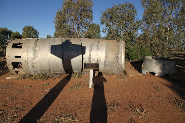
On checking into the pub, we checked the road conditions out to Halligans Bay on Lake Eyre. According to all the reports it was pretty rough. The last 15km taking about 1½ hours to do. We decided to give this one a skip. Instead we had a bit of a relax afternoon. Jodie read and I had a bit of a walk around with the camera. There were a few old rockets that had been collected from around the region that had crashed back to earth after being launched from Woomera.


I also finally caught up on all of the blog posts for the last week or so. I think I will have to shorten them so they don't take up so much time to put together.

That night we had dinner at the William Creek Hotel. It certainly didn't have the same feel as the Maree Pub. There were no locals. The whole town of William Creek feels like it is just a tourist town. We felt that if the tourists didn't come here as a jumping off point to Lake Eyre, then it probably wouldn't exist. Maree at least had a town that wasn't built around tourists and charging tourist prices. It was also the most expensive for diesel so far. $2.30 per litre!!

Check-in/OK message from Steve and Jodie's SPOT SPOT Personal Tracker

Steve and Jodie's SPOT
Latitude:-28.90892
Longitude:136.33858
GPS location Date/Time:05/21/2012 12:30:21 EST

Message:We are ok and nothing to report. Check your e-mail to see us on the map.

Click the link below to see where I am located.
http://fms.ws/7z0pA/28.90892S/136.33858E

If the above link does not work, try this link:
http://maps.google.com/maps?f=q&hl=en&geocode=&q=-28.90892,136.33858&ll=-28.90892,136.33858&ie=UTF8&z=12&om=1

Steve and Jodie's SPOT

You have received this message because Steve and Jodie's SPOT has added you to their SPOT contact list.

Every day is an Adventure. Share Yours.
http://www.findmespot.com

Sunday, 20 May 2012

Check-in/OK message from Steve and Jodie's SPOT SPOT Personal Tracker

Steve and Jodie's SPOT
Latitude:-29.40077
Longitude:136.81412
GPS location Date/Time:05/20/2012 15:32:40 EST

Message:We are ok and nothing to report. Check your e-mail to see us on the map.

Click the link below to see where I am located.
http://fms.ws/7yNk4/29.40077S/136.81412E

If the above link does not work, try this link:
http://maps.google.com/maps?f=q&hl=en&geocode=&q=-29.40077,136.81412&ll=-29.40077,136.81412&ie=UTF8&z=12&om=1

Steve and Jodie's SPOT

You have received this message because Steve and Jodie's SPOT has added you to their SPOT contact list.

Every day is an Adventure. Share Yours.
http://www.findmespot.com

Oz Trip - Day 19 - Coward Springs

Day 19 – 20/5/2012 – Coward Springs

We left Muloorina Station re fuelled in Maree again and headed towards Coward Springs. Lots more dirt, corrugations and flies!!

I think living in the desert must send people a bit loopy, or they just have way too much spare time on their hands. Here are some of the strange things that we saw at a place called “Plane Henge”.

Plane Henge

Saturday, 19 May 2012

Check-in/OK message from Steve and Jodie's SPOT SPOT Personal Tracker

Steve and Jodie's SPOT
Latitude:-29.23909
Longitude:137.89853
GPS location Date/Time:05/19/2012 15:19:06 EST

Message:We are ok and nothing to report. Check your e-mail to see us on the map.

Click the link below to see where I am located.
http://fms.ws/7xbQU/29.23909S/137.89853E

If the above link does not work, try this link:
http://maps.google.com/maps?f=q&hl=en&geocode=&q=-29.23909,137.89853&ll=-29.23909,137.89853&ie=UTF8&z=12&om=1

Steve and Jodie's SPOT

You have received this message because Steve and Jodie's SPOT has added you to their SPOT contact list.

Every day is an Adventure. Share Yours.
http://www.findmespot.com

Oz Trip - Day 18

Day 18 – 19/5/2012 – Muloorina Station and Level Post Bay Lake Eyre

We had a bit of a sleep in as we were only heading 50km up the road to Muloorina Station. We were going to drop the camper off there and then head the extra 50km to Level Post Bay on Lake Eyre.

Marree General Store and Servo

Check-in/OK message from Steve and Jodie's SPOT SPOT Personal Tracker

Steve and Jodie's SPOT
Latitude:-28.98239
Longitude:137.73619
GPS location Date/Time:05/19/2012 13:10:42 EST

Message:We are ok and nothing to report. Check your e-mail to see us on the map.

Click the link below to see where I am located.
http://fms.ws/7xYVu/28.98239S/137.73619E

If the above link does not work, try this link:
http://maps.google.com/maps?f=q&hl=en&geocode=&q=-28.98239,137.73619&ll=-28.98239,137.73619&ie=UTF8&z=12&om=1

Steve and Jodie's SPOT

You have received this message because Steve and Jodie's SPOT has added you to their SPOT contact list.

Every day is an Adventure. Share Yours.
http://www.findmespot.com

Check-in/OK message from Steve and Jodie's SPOT SPOT Personal Tracker

Steve and Jodie's SPOT
Latitude:-29.23909
Longitude:137.8985
GPS location Date/Time:05/19/2012 11:13:40 EST

Message:We are ok and nothing to report. Check your e-mail to see us on the map.

Click the link below to see where I am located.
http://fms.ws/7xVND/29.23909S/137.8985E

If the above link does not work, try this link:
http://maps.google.com/maps?f=q&hl=en&geocode=&q=-29.23909,137.8985&ll=-29.23909,137.8985&ie=UTF8&z=12&om=1

Steve and Jodie's SPOT

You have received this message because Steve and Jodie's SPOT has added you to their SPOT contact list.

Every day is an Adventure. Share Yours.
http://www.findmespot.com

Friday, 18 May 2012

Oz Trip - Day 17

Day 17 – 18/5/2012 – Marree (Start of the Oodnadatta Track)

Well we finally got back on the road. We had to do a bit of back tracking to Hawker where we had another milkshake for smoko :-)

Next stop was Leigh Creek. It wasn't quite what we expected. It was nothing like the old towns of Quorn and Hawker with the stone buildings. It looked like it was a purpose built town for the mine that was nearby. It had a town centre where the IGA, post office, pub, info centre and a few various other shops were all centred in the on complex and then the streets all radiated out from there.

You can just see the mine in the distance

Check-in/OK message from Steve and Jodie's SPOT SPOT Personal Tracker

Steve and Jodie's SPOT
Latitude:-29.64922
Longitude:138.06488
GPS location Date/Time:05/18/2012 16:43:36 EST

Message:We are ok and nothing to report. Check your e-mail to see us on the map.

Click the link below to see where I am located.
http://fms.ws/7wtvz/29.64922S/138.06488E

If the above link does not work, try this link:
http://maps.google.com/maps?f=q&hl=en&geocode=&q=-29.64922,138.06488&ll=-29.64922,138.06488&ie=UTF8&z=12&om=1

Steve and Jodie's SPOT

You have received this message because Steve and Jodie's SPOT has added you to their SPOT contact list.

Every day is an Adventure. Share Yours.
http://www.findmespot.com

Thursday, 17 May 2012

Oz Trip - Day 16

Day 16 – 17/5/2012 – Port Augusta, Still!!!

Had to wait around to about 4pm to pick the Pajero up. All fixed under warranty. Once picked up I also had to get the mounting bracket that holds the monitor for the rear view camera on the van re-glued back onto the windscreen. Luckily Windscreen O'Brians were right next door to the Mitsubishi dealer ship.

On the way back to the van park we did a final restock in hope of leaving tomorrow.  Fingers crossed.

Wednesday, 16 May 2012

Oz Trip - Day 15

Day 15 – 16/5/2012 – Port Augusta Again....

Well the best laid plans always come unstuck!! We hitched up and checked out of the van park. While idling through the back streets making our way to the main road, the “check engine” light came on again! So it was straight back to the dealer. They wouldn't be able to look at it again until after lunch, so it didn't look like we were going anywhere today.

We checked back into the van park and setup on the same spot that we just left. I dropped the Pajero back to the dealer and got a lift back to the van park.

That afternoon they rang back and said that the EGR (Exhaust Gas Recirculation) valve need to be replaced because it was clogged up with soot and they didn't have one in stock so they had to get it sent in over night. So while the Pajero was having a sleep over at the dealership, we had a bit of time to relax and catch up on some blog posts :-)

Port Augusta seems to be a bit of a location where vehicle problems manifest themselves in our family. My uncle was stuck here for a couple of weeks getting his gear box replaced in his motor home and my cousin also had wheel problems and had to get patched up on their way through the town.

Tuesday, 15 May 2012

Oz Trip - Day 14

Day 14 – 15/5/2012 – Port Augusta

We managed to make it to Port Augusta just before lunch time.  Luckily the fault didn't cause the engine to go into "Limp Home" mode where it reduces the power and speed at which you can travel.  It wouldn't have been fun towing a 2 tonne camper with only 20% engine power and limited to 60kph for 200 or so kilometres through hills! We dropped the van off at the Big 4 van park and I headed back to the dealership to drop the Pajero off. Luckily they were able to look at it for us that afternoon.

When entering all of my details they found that it hadn't had an “update” applied to its computer. For the non technical, basically it needed a bit of software loaded into it, similar to applying a windows update to your computer. They said that they had just recently had another Pajero in with the same problem and had to apply the same fix. Apparently when towing with the engine under load and in certain conditions can generate a fault code which causes the check engine light to turn on. So they applied the “patch” and I was good to go.

The stop at Port Augusta also gave us the change to stock up on some food and water and ready to hit the road again tomorrow morning.

Check-in/OK message from Steve and Jodie's SPOT SPOT Personal Tracker

Steve and Jodie's SPOT
Latitude:-32.47836
Longitude:137.75456
GPS location Date/Time:05/15/2012 12:45:34 EST

Message:We are ok and nothing to report. Check your e-mail to see us on the map.

Click the link below to see where I am located.
http://fms.ws/7ucJG/32.47836S/137.75456E

If the above link does not work, try this link:
http://maps.google.com/maps?f=q&hl=en&geocode=&q=-32.47836,137.75456&ll=-32.47836,137.75456&ie=UTF8&z=12&om=1

Steve and Jodie's SPOT

You have received this message because Steve and Jodie's SPOT has added you to their SPOT contact list.

Every day is an Adventure. Share Yours.
http://www.findmespot.com

Monday, 14 May 2012

Oz Trip - Day 13

Day 13 – 14/5/2012 – Bush Walk Day (a day out of the car!)

At last, a day not driving!!! We finally had a day where we were going to do a bush walk. We walked up to the Hills Homestead and then on to the two Wangara lookouts into Wilpena Pound. It gave you a really good view into the Pound. You had to walk through the only entrance into the Pound which followed Wilpena Creek. All up it was about an 8km walk.

The water source for Wilpena Resourt

Sunday, 13 May 2012

Oz Trip - Day 12

Day 12 – 13/5/2012 – SkyTrek

This morning was the coldest that we had had so far. The temperature dropped down to 0.7deg over night. Not the sort of temperature you want when you have to get up relatively early, again!

It was also going to be another bumpy day on the road. We were going to do the Skytrek self drive tour today from the Willow Springs Station. It use to take you to the highest point in the Flinders Rangers that you could drive too, but some greedy conservationists put an end to that (purely my take on it, you can make up your own mind). Don't get me wrong, I am all about conservation and protecting the endangered animals, but to me it looks more like a bit of a money grab than anything to do with the well-being of the yellow footed rock wallaby. You can read all about it on the Willow Springs web site http://www.skytrekwillowsprings.com.au/resources/media1202.pdf.
So now the tour is all on the Willow Springs station.

We were only able to do about half of the tour because the caretakers said that the back half of the track was so dry and the bull dust was so thick that they didn't want to risk anybody getting stuck out there. As it was we still managed to find some pretty thick patches of it. The Pajero was absolutely coated in it. It was so think on the rear tailgate I had to use a brush to try and scrape it out once we were back at camp.

The first part of the tour took you through the gorges and out to an old homestead building.


Saturday, 12 May 2012

Oz Trip - Day 11

Day 11 – 12/5/2012 – Flight over Wilpena Pound and Geological Trail

Another early start as we were booked in to do a 30min flight over Wilpena Pound and Flinders Ranges at 7:30am. It was a perfect day for the flight. Clear and no wind. It was going to be my first time in a light aircraft. When we turned up at the airport we found out that there were 3 other people also booked on our flight. So with the pilot that made 6 of us in the small plane. None of us were exactly tiny either!

The plane

Friday, 11 May 2012

Oz Trip - Day 10

Day 10 – 11/5/2012 – Hawker Day Trip

Because we had used up all of our fresh fruit and vegies before we hit the South Australian boarder and fruit fly zones, we needed to restock. We were planning on restocking at Yunta before we hit the dirt road but that town only ended up being pretty much two truck stops and we couldn't get anything. We were also planning on restocking at the Wilpena “Resort” because they said that they had a well stocked shop. They did, but not really with fresh fruit and vegies.

Thursday, 10 May 2012

Oz Trip - Day 9

Day 9 – 10/5/2012 – Penrose Park to Wilpena
An early start as we were heading to Wilpena Pound in the Flinders Rangers. We were up at 6 and packed up by 7:30. We topped up the water tanks from a rain water tank on one of the sheds and was on the road by 8:15. We were a bit sad to leave as we really liked the peace and quite of the place.

At Yunta we turned off the main highway and hit the dirt minor road once again. The roads were open but there was warnings for sections of bull dust. It was a very scenic route despite the fact that it was slower than the sealed way. 
Airing down for the dirt road

Check-in/OK message from Steve and Jodie's SPOT SPOT Personal Tracker

Steve and Jodie's SPOT
Latitude:-31.52461
Longitude:138.60362
GPS location Date/Time:05/10/2012 17:44:53 EST

Message:We are ok and nothing to report. Check your e-mail to see us on the map.

Click the link below to see where I am located.
http://fms.ws/7rIL_/31.52461S/138.60362E

If the above link does not work, try this link:
http://maps.google.com/maps?f=q&hl=en&geocode=&q=-31.52461,138.60362&ll=-31.52461,138.60362&ie=UTF8&z=12&om=1

Steve and Jodie's SPOT

You have received this message because Steve and Jodie's SPOT has added you to their SPOT contact list.

Every day is an Adventure. Share Yours.
http://www.findmespot.com

Wednesday, 9 May 2012

Oz Trip - Day 8

Day 8 – 9/5/2012 – Sightseeing Day

It ended up being a very warm night and you could feel that it was going to be a warm day. I think the temperature only went down to about 15 deg over night. A nice pleasant night.

Now that the jobs were out of the way, It was time to do a bit of sightseeing. On the way back into Broken Hill we stopped in to pick up the fixed Stone Stomper. The guy had done a great job at fixing it and reinforcing it.

Next stop was the Miners Memorial and the Big Bench at the top of the dirt hill in the centre of town. It had great views out over Broken Hill and the surrounding areas.

Memorial to the Miners who have lost their lives in Broken Hill Mines

Tuesday, 8 May 2012

Oz Trip - Day 7

Day 7 – 8/5/2012 – Broken Hill Jobs Day

Today was basically a jobs day. First thing was to find an upholster to fix the Stone Stomper in Broken Hill. After dropping the Stone Stomper off it was off to the hardware shop to get some new shackles to attach it back onto the camper. At that point I had thought I had lost my wallet so we drove back to camp to see if I had left it there, luckily I had! We also took the time to have lunch at camp.

After lunch it was back to Broken Hill to find Coles and Woolies to restock. On the way out we though we would just do a quick spin through Silverton as it was only about 1km up the road. When we drove into Silverton we were greeted by some donkeys! With all of the dirt and old stone buildings it sort of made you feel like you were in a Mexican ghost town. Very strange. We saw a few things that we were going to come back and checkout.

A Silverton donkey
With the shopping completed we stopped off at Bells Milk Bar for an old fashioned spider. Bells Mike Bar is a real 50's milk bar.

That afternoon I went to the Mundi Mundi plains lookout just past Silverton to watch the sunset. It was obviously a popular thing to do as there was a coach tour bus and quite a few other motor homes and cars there as well with their tables and chairs all set up having their wine and cheese. From the lookout you look down onto the Mundi Mundi Plains that extend out to the horizon. It was nice watching the sun set over the western plains while having a beer, but I don't think it was as impressive as it could have been. Because it was a cloudless sky, there weren't any of the fantastic red colours that you can get. We saw these as we were arriving the afternoon before. Don't get me wrong it was still pretty impressive.

Sunset from Mundi Mundi Lookout

Monday, 7 May 2012

Oz Trip - Day 6

Day 6 – 7/5/2012 – Trilby Station to Penrose Park

We were up just on sunrise as we had another early start. The morning was fantastic. There were pelicans soaring around and swimming up the river all against an orange sunrise.

Sunrise over Trilby Station

Check-in/OK message from Steve and Jodie's SPOT SPOT Personal Tracker

Steve and Jodie's SPOT
Latitude:-31.88206
Longitude:141.2283
GPS location Date/Time:05/07/2012 18:36:24 EST

Message:We are ok and nothing to report. Check your e-mail to see us on the map.

Click the link below to see where I am located.
http://fms.ws/7pGnD/31.88206S/141.2283E

If the above link does not work, try this link:
http://maps.google.com/maps?f=q&hl=en&geocode=&q=-31.88206,141.2283&ll=-31.88206,141.2283&ie=UTF8&z=12&om=1

Steve and Jodie's SPOT

You have received this message because Steve and Jodie's SPOT has added you to their SPOT contact list.

Every day is an Adventure. Share Yours.
http://www.findmespot.com

Sunday, 6 May 2012

Oz Trip - Day 5

Day 5 – 6/5/2012 – North Bourke to Trilby Station

Because Trilby Station was only just over 100km away, we didn't really need to get up in hurry. It did end up being a cold night. It got down to 3.8deg over night. We still didn't have to crank up the diesel heater at all yet. We are saving it until it gets really cold!!

Liz, (the owner from Trilby Station), asked us to pick up a Sunday paper for her on our way out. She doesn't normally get the Sunday paper until Tuesday so she was pretty excited to get it on the actual day. We had to wait until at least 10am before the papers arrived in town so to fill in time we went for a walk back down to the river. This time with our camera to get some photos of the birds.


Pelicans inland


Check-in/OK message from Steve and Jodie's SPOT SPOT Personal Tracker

Steve and Jodie's SPOT
Latitude:-30.64664
Longitude:144.93068
GPS location Date/Time:05/06/2012 13:29:36 EST

Message:We are ok and nothing to report. Check your e-mail to see us on the map.

Click the link below to see where I am located.
http://fms.ws/7oWx5/30.64664S/144.93068E

If the above link does not work, try this link:
http://maps.google.com/maps?f=q&hl=en&geocode=&q=-30.64664,144.93068&ll=-30.64664,144.93068&ie=UTF8&z=12&om=1

Steve and Jodie's SPOT

You have received this message because Steve and Jodie's SPOT has added you to their SPOT contact list.

Every day is an Adventure. Share Yours.
http://www.findmespot.com

Saturday, 5 May 2012

OZ Trip - Day 4

Day 4 – 5/5/2012 – Lightening Ridge to North Bourke
It was starting to get a bit chiller. Awoke to a 7.8deg crisp clear morning. We were on the road fairly early again. There was not much traffic on the roads which was good. We headed to Walgett first. The vegetation was starting to thin out as we were starting to get further west. We were also starting to see quite a few Emu's.

Stopped at Brewarrina for a top of diesel. It was chaos at the only servo. The Walgett Rugby team bus had stopped and they were all stocking up on snacks and car and 4wd's going every which way.

From there we headed over to have a quick look at the Aboriginal Fish Traps in the river. Unfortunately we couldn't see them because the water level in the river was still high and the river was flowing fairly fast. There were some aboriginal kids in the river catching some fish.
Flooded Fish traps

Check-in/OK message from Steve and Jodie's SPOT SPOT Personal Tracker

Steve and Jodie's SPOT
Latitude:-30.04597
Longitude:145.95691
GPS location Date/Time:05/05/2012 15:11:34 EST

Message:We are ok and nothing to report. Check your e-mail to see us on the map.

Click the link below to see where I am located.
http://fms.ws/7ntZC/30.04597S/145.95691E

If the above link does not work, try this link:
http://maps.google.com/maps?f=q&hl=en&geocode=&q=-30.04597,145.95691&ll=-30.04597,145.95691&ie=UTF8&z=12&om=1

Steve and Jodie's SPOT

You have received this message because Steve and Jodie's SPOT has added you to their SPOT contact list.

Every day is an Adventure. Share Yours.
http://www.findmespot.com

Friday, 4 May 2012

Oz Trip - Day 3

Day 3 – 4/5/2012 - St George to Lightening Ridge
Another short day. Even though we slept in until about 7:30, we were on the road just before 9am. First stop was Dirranbandi for smoko and we made Lightening Ridge for lunch. We checked into the Opal Caravan park which was only a couple of hundred meters from the Artesian Baths. After lunch we had a swim in the baths. It was fantastic. The water was a constant 40deg. So relaxing.

Artesian Baths

Check-in/OK message from Steve and Jodie's SPOT SPOT Personal Tracker

Steve and Jodie's SPOT
Latitude:-29.42575
Longitude:147.99594
GPS location Date/Time:05/04/2012 12:55:10 EST

Message:We are ok and nothing to report. Check your e-mail to see us on the map.

Click the link below to see where I am located.
http://fms.ws/7nAWx/29.42575S/147.99594E

If the above link does not work, try this link:
http://maps.google.com/maps?f=q&hl=en&geocode=&q=-29.42575,147.99594&ll=-29.42575,147.99594&ie=UTF8&z=12&om=1

Steve and Jodie's SPOT

You have received this message because Steve and Jodie's SPOT has added you to their SPOT contact list.

Every day is an Adventure. Share Yours.
http://www.findmespot.com

Thursday, 3 May 2012

Oz Trip - Day 2

Day 2 – 3/5/2012 - Kumbia to St George
Just another day of driving, and there will probably be a lot more of these!! As it was a fairly short day we managed to get to St George by around 2pm. Instead of staying in town we stayed at a place called Kapunda Tourist and Fishing Park. We had a nice site down by the Balonne River. We were also on the outskirts of a severe storm warning so it was nice to just kick back and watch the storm clouds in the distance as the sun set. A very peaceful place.

Camp beside Balonne River

Check-in/OK message from Steve and Jodie's SPOT SPOT Personal Tracker

Steve and Jodie's SPOT
Latitude:-27.987
Longitude:148.65704
GPS location Date/Time:05/03/2012 15:41:30 EST

Message:We are ok and nothing to report. Check your e-mail to see us on the map.

Click the link below to see where I am located.
http://fms.ws/7mZtq/27.987S/148.65704E

If the above link does not work, try this link:
http://maps.google.com/maps?f=q&hl=en&geocode=&q=-27.987,148.65704&ll=-27.987,148.65704&ie=UTF8&z=12&om=1

Steve and Jodie's SPOT

You have received this message because Steve and Jodie's SPOT has added you to their SPOT contact list.

Every day is an Adventure. Share Yours.
http://www.findmespot.com

Wednesday, 2 May 2012

Oz Trip - Day 1

Oz Trip - 2/5/2011 - Bargara to Kumbia

Well today was the first day of the big trip. We had an early start and were on the road by 9am after finishing off a few last minute jobs. Because we have a bit more time with this trip, we don't have to push as far or fast per day.

We made the first stop, Kumbia, a little place south of Kingaroy and pretty much at the base of the Bunya Mountains.  Even early in the afternoon you could feel the cool air coming down from the mountains.

We arrived at about 1:30pm. By arriving early it allowed us to get a place in the free camp. There was only about 4 other people here when we arrived but the place soon filled up. Another 5 groups arrived after us. Some even turning up at about 5:30pm and just squeezing in.

Kumbia free camp

Check-in/OK message from Steve and Jodie's SPOT SPOT Personal Tracker

Steve and Jodie's SPOT
Latitude:-26.6926
Longitude:151.65286
GPS location Date/Time:05/02/2012 14:05:27 EST

Message:We are ok and nothing to report. Check your e-mail to see us on the map.

Click the link below to see where I am located.
http://fms.ws/7ltym/26.6926S/151.65286E

If the above link does not work, try this link:
http://maps.google.com/maps?f=q&hl=en&geocode=&q=-26.6926,151.65286&ll=-26.6926,151.65286&ie=UTF8&z=12&om=1

Steve and Jodie's SPOT

You have received this message because Steve and Jodie's SPOT has added you to their SPOT contact list.

Every day is an Adventure. Share Yours.
http://www.findmespot.com