Tuesday 26 August 2014

Charleville Trip - Day 7

Day 7 – 26/8/2014 – Cania Gorge to Home

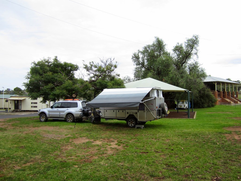
Being the last day of the trip and not having far to get home, it was a relatively slow pack up. 
We headed home via Mt Perry and arrived home just after lunch time. This gave us enough time to get unpacked, cleaned up and ready to go back to work the next day :-(
Breakfast with instant friends!

Monday 25 August 2014

Check-in/OK message from SPOT Steve and Jodie's

Steve and Jodie's
Latitude:-24.66179
Longitude:150.96045
GPS location Date/Time:08/25/2014 16:09:04 EST

Message:We are ok and nothing to report. Check out http://goo.gl/B5bhih to follow us

Click the link below to see where I am located.
http://fms.ws/IqyRG/24.66179S/150.96045E

If the above link does not work, try this link:
http://maps.google.com/maps?f=q&hl=en&geocode=&q=-24.66179,150.96045&ll=-24.66179,150.96045&ie=UTF8&z=12&om=1

Steve and Jodie's

You have received this message because Steve and Jodie's has added you to their SPOT contact list.

Ready for Adventure
FindMeSPOT.com

Charleville Trip - Day 6

Day 6 – 25/8/2014 – Springsure to Cania Gorge

From Springsure we knew that if we put in a big day that we could make it home to Bundaberg. But with me not feeling 100%, because I picked up a flu, we decided to take it a bit easier and have one more stop at one of our favourite places, Cania Gorge.


Springsure Show grounds

Sunday 24 August 2014

Check-in/OK message from SPOT Steve and Jodie's

Steve and Jodie's
Latitude:-24.12103
Longitude:148.08350
GPS location Date/Time:08/24/2014 16:43:06 EST

Message:We are ok and nothing to report. Check out http://goo.gl/B5bhih to follow us

Click the link below to see where I am located.
http://fms.ws/Ipo_m/24.12103S/148.08350E

If the above link does not work, try this link:
http://maps.google.com/maps?f=q&hl=en&geocode=&q=-24.12103,148.08350&ll=-24.12103,148.08350&ie=UTF8&z=12&om=1

Steve and Jodie's

You have received this message because Steve and Jodie's has added you to their SPOT contact list.

Ready for Adventure
FindMeSPOT.com

Charleville Trip - Day 5

Day 5 – 24/8/2014 – Charleville to Springsure

The lightening visit to Charleville was over. It was time to start making our way home again. It was only a quick trip to get a feel for the area and to see what we want to do next time.

Instead of heading home the same way that we came, we decided to head towards Springsure via Tambo. We were initially going to follow the Ward River via Black Ward Road because the people at the visitors info centre said that there were some nice camping sites along the river and we wanted to check them out for future reference. However no one could give us any reliable information to the condition of the road. A week or so beforehand Charleville had record breaking rainfall for the month of August. Given that the road would have been going through black soil country, and we didn't know the condition of the road, so we decide to just stick to the tarmac. Black soil gets very boggy, slippery and sticky with very little moisture and it is not something that you want to get stuck in.

So we ended up stopping in Augathella, meatant country, for smoko.


Saturday 23 August 2014

Charleville Trip - Day 4

Day 4 – 23/8/2014 – Charleville

The only plans we had for the day was to do a bit of a walk around the Charleville town centre, so we weren't in any hurry to get moving.


Friday 22 August 2014

Check-in/OK message from SPOT Steve and Jodie's

Steve and Jodie's
Latitude:-26.36526
Longitude:146.15646
GPS location Date/Time:08/22/2014 15:03:58 EST

Message:We are ok and nothing to report. Check out http://goo.gl/B5bhih to follow us

Click the link below to see where I am located.
http://fms.ws/InE_i/26.36526S/146.15646E

If the above link does not work, try this link:
http://maps.google.com/maps?f=q&hl=en&geocode=&q=-26.36526,146.15646&ll=-26.36526,146.15646&ie=UTF8&z=12&om=1

Steve and Jodie's

You have received this message because Steve and Jodie's has added you to their SPOT contact list.

Ready for Adventure
FindMeSPOT.com

Charleville Trip - Day 3

Day 3 – 22/8/2014 – Roma to Charleville

Basically just a driving day and passing trough some small towns. We stopped for smoko at Mitchell.


Thursday 21 August 2014

Charleville Trip - Day 2

Day 2 – 21/8/2014 – Ban Ban Springs to Roma

To get to Roma we weren't going to take the most direct route. Instead we were trying to travel on roads that we hadn't previously travelled to see some new towns. So instead of heading south towards Dalby we took a slightly longer way by going north through Gayndah and then Mundubbera and then south to Chinchilla via Jandowae.


Check-in/OK message from SPOT Steve and Jodie's

Steve and Jodie's
Latitude:-26.57310
Longitude:148.79837
GPS location Date/Time:08/21/2014 16:00:33 EST

Message:We are ok and nothing to report. Check out http://goo.gl/B5bhih to follow us

Click the link below to see where I am located.
http://fms.ws/Ily4N/26.57310S/148.79837E

If the above link does not work, try this link:
http://maps.google.com/maps?f=q&hl=en&geocode=&q=-26.57310,148.79837&ll=-26.57310,148.79837&ie=UTF8&z=12&om=1

Steve and Jodie's

You have received this message because Steve and Jodie's has added you to their SPOT contact list.

Ready for Adventure
FindMeSPOT.com

Wednesday 20 August 2014

Check-in/OK message from SPOT Steve and Jodie's

Steve and Jodie's
Latitude:-25.68140
Longitude:151.81496
GPS location Date/Time:08/20/2014 17:54:11 EST

Message:We are ok and nothing to report. Check out http://goo.gl/B5bhih to follow us

Click the link below to see where I am located.
http://fms.ws/IkidK/25.68140S/151.81496E

If the above link does not work, try this link:
http://maps.google.com/maps?f=q&hl=en&geocode=&q=-25.68140,151.81496&ll=-25.68140,151.81496&ie=UTF8&z=12&om=1

Steve and Jodie's

You have received this message because Steve and Jodie's has added you to their SPOT contact list.

Ready for Adventure
FindMeSPOT.com

Charleville Trip - Day 1

Day 1 – 20/8/2014 – Ban Ban Springs

Well I have finally had time to put together our quick Charleville trip from a couple of months ago. At least this time it won't be as strung out as the Tasmania Trip write up :-).

We were able to squeeze in a few days off so we thought that we would do a little bit of exploring around an area of Queensland that we haven't been before. We were able to take off from work a little bit early, and from being pretty much packed up from the night before we were able to make it to Ban Ban Springs just as the sun was setting.

Because we were getting into a free camp pretty late we were expecting to not be able to find a decent site and would be pretty much camped right beside the highway. As luck would have it, we found a relatively nice area that was right beside the springs and away from the highway.

Because it was dark when we set up camp I didn't get any photos so I am going to cheat and use a photo from the next morning :-)


Monday 3 March 2014

Tasmania Trip - Epilogue

Tasmania Trip - Epilogue

Here is the high tech track log of the trip :-) I couldn't be bothered trying to use my GPS to record the track log because with the slow winding terrain, its memory would have filled up before I had a chance to download it each day.


Sunday 2 March 2014

Tasmania Trip - Day 37

Day 37 - 2/3/2014 – Bunya Mountains to Bundaberg

Unfortunately it was the last day of holidays, so we weren't exactly enthusiastic to pack up and head off.


Saturday 1 March 2014

Tasmania Trip - Day 36

Day 36 - 1/3/2014 – Goondwindi to Bunya Mountains

We could have pushed on straight to home, but because we had a day up our sleeves we decided to take it a bit easier and have a stop over at another one of our favourite places, the Bunya Mountains.

There are only three ways to get to the Bunya Mountains. On a previous trip we had scoped out all three routes to see which access would be the easiest to get the camper up the mountain. We had to skirt around the base of the mountains to the Maidenwell side to access the path we wanted. In the process we passed through another small township called Maclagan

There wasn't much else in the main street!

Check-in/OK message from SPOT Steve and Jodie's

Steve and Jodie's
Latitude:-26.88065
Longitude:151.59711
GPS location Date/Time:03/01/2014 14:22:06 EST

Message:We are ok and nothing to report. Check out http://goo.gl/B5bhih to follow us

Click the link below to see where I am located.
http://fms.ws/Fmsfs/26.88065S/151.59711E

If the above link does not work, try this link:
http://maps.google.com/maps?f=q&hl=en&geocode=&q=-26.88065,151.59711&ll=-26.88065,151.59711&ie=UTF8&z=12&om=1

Steve and Jodie's

You have received this message because Steve and Jodie's has added you to their SPOT contact list.

Ready for Adventure
FindMeSPOT.com

Friday 28 February 2014

Tasmania Trip - Day 35

Day 35 - 28/2/2014 – Parks to Goondwindi

Just another day behind the wheel, although not quite as long today which was good.

Nearly packed up at Parks

Check-in/OK message from SPOT Steve and Jodie's

Steve and Jodie's
Latitude:-28.53308
Longitude:150.32251
GPS location Date/Time:02/28/2014 17:02:58 EST

Message:We are ok and nothing to report. Check out http://goo.gl/B5bhih to follow us

Click the link below to see where I am located.
http://fms.ws/Fm7fe/28.53308S/150.32251E

If the above link does not work, try this link:
http://maps.google.com/maps?f=q&hl=en&geocode=&q=-28.53308,150.32251&ll=-28.53308,150.32251&ie=UTF8&z=12&om=1

Steve and Jodie's

You have received this message because Steve and Jodie's has added you to their SPOT contact list.

Ready for Adventure
FindMeSPOT.com

Thursday 27 February 2014

Tasmania Trip - Day 34

Day 34 - 27/2/2014 – Melbourne to Parks

Even though the seas were slightly less then when we came over, it was still a rough night and we only managed a few hours of some decent sleep after we reached the shelter of Port Phillip Bay.

Check-in/OK message from SPOT Steve and Jodie's

Steve and Jodie's
Latitude:-33.13147
Longitude:148.18105
GPS location Date/Time:02/27/2014 17:19:49 EST

Message:We are ok and nothing to report. Check out http://goo.gl/B5bhih to follow us

Click the link below to see where I am located.
http://fms.ws/FlKqc/33.13147S/148.18105E

If the above link does not work, try this link:
http://maps.google.com/maps?f=q&hl=en&geocode=&q=-33.13147,148.18105&ll=-33.13147,148.18105&ie=UTF8&z=12&om=1

Steve and Jodie's

You have received this message because Steve and Jodie's has added you to their SPOT contact list.

Ready for Adventure
FindMeSPOT.com

Check-in/OK message from SPOT Steve and Jodie's

Steve and Jodie's
Latitude:-33.13153
Longitude:148.18089
GPS location Date/Time:02/27/2014 16:58:29 EST

Message:We are ok and nothing to report. Check out http://goo.gl/B5bhih to follow us

Click the link below to see where I am located.
http://fms.ws/FlKKB/33.13153S/148.18089E

If the above link does not work, try this link:
http://maps.google.com/maps?f=q&hl=en&geocode=&q=-33.13153,148.18089&ll=-33.13153,148.18089&ie=UTF8&z=12&om=1

Steve and Jodie's

You have received this message because Steve and Jodie's has added you to their SPOT contact list.

Ready for Adventure
FindMeSPOT.com

Wednesday 26 February 2014

Tasmania Trip - Day 33

Day 33 - 26/2/2014 – Devonport to Melbourne

Another sleep in and late start. It was going to be pretty much just a day just sitting around and taking it easy. We couldn't board until 5pm for a 7:30pm departure, and we were only 10 minutes away from the boarding dock. The van park was really good as you could pay about $10 extra and you could stay on the site until you needed to board. In hindsight we could have spent an extra day somewhere else and just driven into Devonport closer to boarding time. However it was good just having another recuperation day because we had a long drive ahead of us.
Another Quantum 3 in front if us

Check-in/OK message from SPOT Steve and Jodie's

Steve and Jodie's
Latitude:-41.04340
Longitude:146.31688
GPS location Date/Time:02/26/2014 19:13:27 EST

Message:We are ok and nothing to report. Check out http://goo.gl/B5bhih to follow us

Click the link below to see where I am located.
http://fms.ws/FkZS_/41.04340S/146.31688E

If the above link does not work, try this link:
http://maps.google.com/maps?f=q&hl=en&geocode=&q=-41.04340,146.31688&ll=-41.04340,146.31688&ie=UTF8&z=12&om=1

Steve and Jodie's

You have received this message because Steve and Jodie's has added you to their SPOT contact list.

Ready for Adventure
FindMeSPOT.com

Tuesday 25 February 2014

Tasmania Trip - Day 32

Day 32 - 25/2/2014 – Launceston to Devenport

It was pretty much our last full day in Tasmania. We didn't have far to go or much planned so it was another slow start. Basically catching our breath before the fast push home in a couple of days time.

We took the back roads to Devenport passing through some nice scenery and small towns.


Check-in/OK message from SPOT Steve and Jodie's

Steve and Jodie's
Latitude:-41.17258
Longitude:146.37668
GPS location Date/Time:02/25/2014 11:19:16 EST

Message:We are ok and nothing to report. Check out http://goo.gl/B5bhih to follow us

Click the link below to see where I am located.
http://fms.ws/FjZ-C/41.17258S/146.37668E

If the above link does not work, try this link:
http://maps.google.com/maps?f=q&hl=en&geocode=&q=-41.17258,146.37668&ll=-41.17258,146.37668&ie=UTF8&z=12&om=1

Steve and Jodie's

You have received this message because Steve and Jodie's has added you to their SPOT contact list.

Ready for Adventure
FindMeSPOT.com

Monday 24 February 2014

Tasmania Trip - Day 31

Day 31 - 24/2/2014 – Launceston Day Trip/Cataract Gorge

As the only thing planned for the day was a walk around Cataract Gorge and the Launceston CBD, we weren't in any great rush to get moving, especially after the last couple of early starts. We decided to park at Cataract Gorge, take the chairlift across the gorge and then walk into the CDB.


Sunday 23 February 2014

Tasmania Trip - Day 30

Day 30 - 23/2/2014 – Beauty Point to Launceston

Even though we weren't moving far today we had to be up and on the road early as I was doing the Hollybank Treetops adventure. Ziplining through the forest. The tour started at 9am at Hollybank so it was an early pack up to make sure that we could get there in time for the start.

It was absolutely fantastic. It took close to 3 hours to go through the induction and then around to all 6 “cloud stations” - platforms in the trees at heights averaging about 30m above the ground. The highest point being 50m above the valley floor as go from one side of the valley to the other. The lengths of the zipline vary from 15m to 400m. On the 400m length you can hit speeds of about 80kph!

And now for the photos and videos!!!


Unfortunately the instructor was the only one who was allowed to have a GOPRO on, but here is what it looked like!  Again here is a link to the page if you can't view the videos


After lunch at the Hollybank Adventure centre we headed to the van park at Legana. It was one of the closest van parks that we could find to Launceston. It backed right onto the West Tamer Highway. The peace and tranquility of the last few stops was well and truly gone. We spent the afternoon catching up on the boring domestic duties, shopping washing etc etc.

Check-in/OK message from SPOT Steve and Jodie's

Steve and Jodie's
Latitude:-41.37366
Longitude:147.05234
GPS location Date/Time:02/23/2014 13:46:22 EST

Message:We are ok and nothing to report. Check out http://goo.gl/B5bhih to follow us

Click the link below to see where I am located.
http://fms.ws/Fi8z5/41.37366S/147.05234E

If the above link does not work, try this link:
http://maps.google.com/maps?f=q&hl=en&geocode=&q=-41.37366,147.05234&ll=-41.37366,147.05234&ie=UTF8&z=12&om=1

Steve and Jodie's

You have received this message because Steve and Jodie's has added you to their SPOT contact list.

Ready for Adventure
FindMeSPOT.com

Saturday 22 February 2014

Tasmania Trip - Day 29

Day 29 - 22/2/2014 – Myrtle Park to Beauty Point

Well it was our coldest night in Tasmania and the coldest night we had ever had in summer! It dropped to 0.5 deg overnight. We kept the heater running all night so it was a nice and toasty 15 deg or so, which certainly made it bearable.

Check-in/OK message from SPOT Steve and Jodie's

Steve and Jodie's
Latitude:-41.14389
Longitude:146.80725
GPS location Date/Time:02/22/2014 11:12:22 EST

Message:We are ok and nothing to report. Check out http://goo.gl/B5bhih to follow us

Click the link below to see where I am located.
http://fms.ws/FhHQn/41.14389S/146.80725E

If the above link does not work, try this link:
http://maps.google.com/maps?f=q&hl=en&geocode=&q=-41.14389,146.80725&ll=-41.14389,146.80725&ie=UTF8&z=12&om=1

Steve and Jodie's

You have received this message because Steve and Jodie's has added you to their SPOT contact list.

Ready for Adventure
FindMeSPOT.com

Friday 21 February 2014

Tasmania Trip - Day 28

Day 28 - 21/2/2014 – St Helens to Myrtle Park

After a windy night in the van, the next morning was a lot calmer. The first stop of the morning was St Columba Falls.

Check-in/OK message from SPOT Steve and Jodie's

Steve and Jodie's
Latitude:-41.31122
Longitude:147.36528
GPS location Date/Time:02/21/2014 14:22:15 EST

Message:We are ok and nothing to report. Check out http://goo.gl/B5bhih to follow us

Click the link below to see where I am located.
http://fms.ws/Fgb36/41.31122S/147.36528E

If the above link does not work, try this link:
http://maps.google.com/maps?f=q&hl=en&geocode=&q=-41.31122,147.36528&ll=-41.31122,147.36528&ie=UTF8&z=12&om=1

Steve and Jodie's

You have received this message because Steve and Jodie's has added you to their SPOT contact list.

Ready for Adventure
FindMeSPOT.com

Thursday 20 February 2014

Tasmania Trip - Day 27

Day 27 - 20/2/2014 – Coles Bay to St Helens/Bay of Fires

From Coles Bay we headed north to St Helens. We were on the move so early this morning that we actually arrived in St Helens just after 10am. Even when checking in at the van park, the people on the front desk had a bit of a grumble that we were there so early and the site didn't have enough time to “rest” between occupations.

After unhitching and smoko, we headed off to the Bay of Fires. The wind and clouds were also starting to pick up.


Check-in/OK message from SPOT Steve and Jodie's

Steve and Jodie's
Latitude:-41.33434
Longitude:148.25203
GPS location Date/Time:02/20/2014 10:14:27 EST

Message:We are ok and nothing to report. Check out http://goo.gl/B5bhih to follow us

Click the link below to see where I am located.
http://fms.ws/Fffhd/41.33434S/148.25203E

If the above link does not work, try this link:
http://maps.google.com/maps?f=q&hl=en&geocode=&q=-41.33434,148.25203&ll=-41.33434,148.25203&ie=UTF8&z=12&om=1

Steve and Jodie's

You have received this message because Steve and Jodie's has added you to their SPOT contact list.

Ready for Adventure
FindMeSPOT.com

Wednesday 19 February 2014

Tasmania Trip - Day 26

Day 26 - 19/2/2014 – Coles Bay Downpour!

We had a sleep in and a late breakfast. Which turned out to be well timed for us because just as we were packing up and getting ready to leave to do the walk to Wineglass Bay, a storm hit with torrential rain. It dumped 42mm in about 30 minutes!


Tuesday 18 February 2014

Check-in/OK message from SPOT Steve and Jodie's

Steve and Jodie's
Latitude:-42.12306
Longitude:148.28496
GPS location Date/Time:02/18/2014 14:02:40 EST

Message:We are ok and nothing to report. Check out http://goo.gl/B5bhih to follow us

Click the link below to see where I am located.
http://fms.ws/Fe9Ea/42.12306S/148.28496E

If the above link does not work, try this link:
http://maps.google.com/maps?f=q&hl=en&geocode=&q=-42.12306,148.28496&ll=-42.12306,148.28496&ie=UTF8&z=12&om=1

Steve and Jodie's

You have received this message because Steve and Jodie's has added you to their SPOT contact list.

Ready for Adventure
FindMeSPOT.com

Tasmania Trip - Day 25

Day 25 - 18/2/2014 – Port Arthur to Coles Bay (Freycinet NP)

We woke to another fantastic morning. The wind had died down and the grey sky was gone. We decided on doing a quick walk down to the beach before leaving.


Monday 17 February 2014

Tasmania Trip - Day 24

Day 24 - 17/2/2014 – Dover to Port Arthur

We were on the road by about 8:30 this morning as we had a quite a few stops to make on the way to Port Arthur. Too do this we had to back track through Huonville to Hobart and make it through the CBD. For a small CBD they seem to have lanes going every which way. It wasn't easy trying to dive across 2 lanes of traffic to get the right exit, but we managed.

The causeway to Sorell

Check-in/OK message from SPOT Steve and Jodie's

Steve and Jodie's
Latitude:-43.13307
Longitude:147.85919
GPS location Date/Time:02/17/2014 16:37:46 EST

Message:We are ok and nothing to report. Check out http://goo.gl/B5bhih to follow us

Click the link below to see where I am located.
http://fms.ws/FdSw1/43.13307S/147.85919E

If the above link does not work, try this link:
http://maps.google.com/maps?f=q&hl=en&geocode=&q=-43.13307,147.85919&ll=-43.13307,147.85919&ie=UTF8&z=12&om=1

Steve and Jodie's

You have received this message because Steve and Jodie's has added you to their SPOT contact list.

Ready for Adventure
FindMeSPOT.com

Sunday 16 February 2014

Tasmania Trip - Day 23

Day 23 - 16/2/2014 – Huonville to Dover

After a windy and rainy night it was a fantastic morning so we took our time to get moving. We wanted to let the camper dry off a bit before we packed up. It dumped 35mm of rain over night so the ground was a little bit soggy under foot packing up. While things dried out and the gas bottle got filled, it gave us a bit of a chance to take some photos of the camp grounds.


Check-in/OK message from SPOT Steve and Jodie's

Steve and Jodie's
Latitude:-43.31413
Longitude:147.02339
GPS location Date/Time:02/16/2014 16:21:26 EST

Message:We are ok and nothing to report. Check out http://goo.gl/B5bhih to follow us

Click the link below to see where I am located.
http://fms.ws/FcjFa/43.31413S/147.02339E

If the above link does not work, try this link:
http://maps.google.com/maps?f=q&hl=en&geocode=&q=-43.31413,147.02339&ll=-43.31413,147.02339&ie=UTF8&z=12&om=1

Steve and Jodie's

You have received this message because Steve and Jodie's has added you to their SPOT contact list.

Ready for Adventure
FindMeSPOT.com

Saturday 15 February 2014

Tasmania Trip - Day 22

Day 22 - 15/2/2014 – Hobart Day Trip

After a couple of early starts and big driving days, it was time for a bit of a slow day. After a bit of a slow start we headed into Hobart for a bit of a quick look around but the first stop on the way was Mt Wellington. We were lucky enough to be able to catch some glimpses of the city through the breaks in the clouds.

Mt Wellington with the transmission tower in the background

Friday 14 February 2014

Tasmania Trip - Day 21

Day 21 - 14/2/2014 – Teds Beach to Huonville

It was going to be another big day of driving and the first part was backtracking from Teds Beach to our first stop of the day, Russell Falls in the Mt Field National Park for smoko.

Giant carved possum

Check-in/OK message from SPOT Steve and Jodie's

Steve and Jodie's
Latitude:-43.01981
Longitude:147.03722
GPS location Date/Time:02/14/2014 14:55:39 EST

Message:We are ok and nothing to report. Check out http://goo.gl/B5bhih to follow us

Click the link below to see where I am located.
http://fms.ws/Fb2Qs/43.01981S/147.03722E

If the above link does not work, try this link:
http://maps.google.com/maps?f=q&hl=en&geocode=&q=-43.01981,147.03722&ll=-43.01981,147.03722&ie=UTF8&z=12&om=1

Steve and Jodie's

You have received this message because Steve and Jodie's has added you to their SPOT contact list.

Ready for Adventure
FindMeSPOT.com

Thursday 13 February 2014

Tasmania Trip - Day 20

Day 20 - 13/2/2014 – Strahan to Teds Beach (Gordon Dam)

Well it was going to be another big day of driving and lots of winding and hilly terrain, so it was an early rise again.

Strahan Sunrise

Check-in/OK message from SPOT Steve and Jodie's

Steve and Jodie's
Latitude:-42.78668
Longitude:146.06076
GPS location Date/Time:02/13/2014 16:46:28 EST

Message:We are ok and nothing to report. Check out http://goo.gl/B5bhih to follow us

Click the link below to see where I am located.
http://fms.ws/FaFZQ/42.78668S/146.06076E

If the above link does not work, try this link:
http://maps.google.com/maps?f=q&hl=en&geocode=&q=-42.78668,146.06076&ll=-42.78668,146.06076&ie=UTF8&z=12&om=1

Steve and Jodie's

You have received this message because Steve and Jodie's has added you to their SPOT contact list.

Ready for Adventure
FindMeSPOT.com

Wednesday 12 February 2014

Tasmania Trip - Day 19

Day 19 - 12/2/2014 - Strahan, Gordon River and Sir John Falls

Yet another early start! I thought we were meant to be on holidays and catching a few sleepins!!!! We had to be at the seaplane office by 8am for an 8:30am departure. On arrival at the departure point we collected our life jacket belts, worked out the seating in the plan and all climbed aboard. Just after we all buckled in the pilot asked if we were all ok to delay the departure. It was overcast with low cloud, and looking at the rain radar showed a rain band heading for the same area as we were going to fly over, so he recommended that we give it about an hour or so for the weather to clear other wise we wouldn't see anything.


Tuesday 11 February 2014

Tasmania Trip - Day 18

Day 18 - 11/2/2014 - Lake MacKintosh to Strahan


Even though it wasn’t going to be a big day driving wise we still needed an early start because we were going to do a bush walk into Montezuma Falls, one of Tasmania's highest waterfalls.  Being up early also meant that I could take a few more photos! The morning at Lake MacKintosh was magical.


Check-in/OK message from SPOT Steve and Jodie's

Steve and Jodie's
Latitude:-42.15369
Longitude:145.31755
GPS location Date/Time:02/11/2014 15:38:39 EST

Message:We are ok and nothing to report. Check out http://goo.gl/B5bhih to follow us

Click the link below to see where I am located.
http://fms.ws/FYfug/42.15369S/145.31755E

If the above link does not work, try this link:
http://maps.google.com/maps?f=q&hl=en&geocode=&q=-42.15369,145.31755&ll=-42.15369,145.31755&ie=UTF8&z=12&om=1

Steve and Jodie's

You have received this message because Steve and Jodie's has added you to their SPOT contact list.

Ready for Adventure
FindMeSPOT.com

Monday 10 February 2014

Tasmania Trip - Day 17

Day 17 - 10/2/2014 - Black River to Lake MacKintosh

It was an early rise this morning because we had a lot of ground to cover due to the closure of Explores Way and having to double back a fair distance.

Check-in/OK message from SPOT Steve and Jodie's

Steve and Jodie's
Latitude:-41.68494
Longitude:145.65852
GPS location Date/Time:02/10/2014 16:21:52 EST

Message:We are ok and nothing to report. Check out http://goo.gl/B5bhih to follow us

Click the link below to see where I am located.
http://fms.ws/FXw36/41.68494S/145.65852E

If the above link does not work, try this link:
http://maps.google.com/maps?f=q&hl=en&geocode=&q=-41.68494,145.65852&ll=-41.68494,145.65852&ie=UTF8&z=12&om=1

Steve and Jodie's

You have received this message because Steve and Jodie's has added you to their SPOT contact list.

Ready for Adventure
FindMeSPOT.com

Sunday 9 February 2014

Tasmania Trip - Day 16

Day 16 - 9/2/2014 - Stanley to Black River via Arthur River

Well today was really destination unknown!  We were going to take the Western Explorers Way from Arthur River to Corina but the road was closed due to a land slip.  So we decided to just set off towards Arthur River and see where we ended up.
Bridge into Arthur River

Check-in/OK message from SPOT Steve and Jodie's

Steve and Jodie's
Latitude:-40.84665
Longitude:145.31938
GPS location Date/Time:02/09/2014 16:00:04 EST

Message:We are ok and nothing to report. Check out http://goo.gl/B5bhih to follow us

Click the link below to see where I am located.
http://fms.ws/FXHIG/40.84665S/145.31938E

If the above link does not work, try this link:
http://maps.google.com/maps?f=q&hl=en&geocode=&q=-40.84665,145.31938&ll=-40.84665,145.31938&ie=UTF8&z=12&om=1

Steve and Jodie's

You have received this message because Steve and Jodie's has added you to their SPOT contact list.

Ready for Adventure
FindMeSPOT.com

Saturday 8 February 2014

Tasmania Trip - Day 15

Day 15 - 8/2/2014 - Cradle Mountain to Stanley


We checked out right on 10am.  The first stop of the day was at Bernie for a quick shop for everything that we couldn’t restock on at the Sheffield IGA.  It is amazing how few and far between the Coles and Woolies stores are.


Check-in/OK message from SPOT Steve and Jodie's

Steve and Jodie's
Latitude:-40.76344
Longitude:145.29424
GPS location Date/Time:02/08/2014 13:32:57 EST

Message:We are ok and nothing to report. Check out http://goo.gl/B5bhih to follow us

Click the link below to see where I am located.
http://fms.ws/FWXHq/40.76344S/145.29424E

If the above link does not work, try this link:
http://maps.google.com/maps?f=q&hl=en&geocode=&q=-40.76344,145.29424&ll=-40.76344,145.29424&ie=UTF8&z=12&om=1

Steve and Jodie's

You have received this message because Steve and Jodie's has added you to their SPOT contact list.

Ready for Adventure
FindMeSPOT.com

Friday 7 February 2014

Tasmania Trip - Day 14

Day 14 - 7/2/2014 - Cradle Mountain (Marions Lookout)

Overnight the temperature dropped to 3 deg, which was a really nice change from the past week or so.  Today we were going to tackle the walk to Marions Lookout.  It was a about a 7.2km return walk from the Dove Lake car park.  Because we were a little bit earlier than the hordes of tourists, we decided to drive to the Dove Lake car park instead of catching the shuttle bus.  It was a good decision because we saw our first echidna of the trip.


Thursday 6 February 2014

Tasmania Trip - Day 13

Day 13 - 6/2/2014 - Devonport to Cradle Mountain


Well all I can say is that we were glad that we had a cabin!  It allowed us to relax as much as possible.  We had our own shower and toilet, and when things got rough it was good to be lying down in a comfortable bed with a TV to distract you!  The trip wasn’t too bad for the first few hours crossing Port Phillip Bay, but after we went through the heads, that was when things started getting interesting.


We didn’t pass through the heads until about 10pm ish so the first few hours were relatively calm, but after that you could tell that we had hit the swell.  We were on deck 7 out of 11  and our windows were constantly getting a drenching from the waves hitting the bow of the ship and then 5 or seconds later you would hear the spray hit the windows and run down the front of the ship.  I couldn’t photograph it because it was too dark.  You would hear the bang of the wave against the hull, and when looking out the window, you could see a white sheet of water against the sky, and then a few seconds later the water would drench the window that you were looking out.  The ferry was moving up and down so much that it was a bit difficult walking around.  Luckily we had had our showers earlier when we were in the calm water of Port Phillip Bay!  Even when you were lying in bed it felt like you were on a roller coaster with your stomach dropping all of the time.


Here are some stats on the ferry.


We managed to get a couple of hours sleep just as we were nearing Tasmania as the land protected the path of travel a bit.  We had a wake up call via the loudspeaker at 5:30am, just as we were docking in Devonport.  We didn’t have a deep sleep but at least were rested.  At 6am they called for people to start heading down to certain car decks.  Luckily we were in the first group.


A tight fit!

Check-in/OK message from SPOT Steve and Jodie's

Steve and Jodie's
Latitude:-41.57756
Longitude:145.93500
GPS location Date/Time:02/06/2014 10:44:29 EST

Message:We are ok and nothing to report. Check out http://goo.gl/B5bhih to follow us

Click the link below to see where I am located.
http://fms.ws/FU_i-/41.57756S/145.93500E

If the above link does not work, try this link:
http://maps.google.com/maps?f=q&hl=en&geocode=&q=-41.57756,145.93500&ll=-41.57756,145.93500&ie=UTF8&z=12&om=1

Steve and Jodie's

You have received this message because Steve and Jodie's has added you to their SPOT contact list.

Ready for Adventure
FindMeSPOT.com

Wednesday 5 February 2014

Tasmania Trip - Day 12

Day 12 - 5/2/2014 - Boarding the Spirit of Tasmania


We were booked on the night time voyage on the Spirit of Tasmania so we didn’t have to check in until 5pm for a scheduled departure time of 7:30pm.  Because we weren’t familiar with the area where the boarding happens and we had heard that there was a very low bridge on the route that the GPS takes you which has claimed few caravans, we decided to do a test run without the camper to work out how to get there, how long it was going to take us to get there, and make sure we didn’t take the route with the low bridge!  We worked out it was going to take close to an hour to travel the 28km to get to the dock so we left the van park at 4pm.


Ready to battle Melbourne traffic, again!

Tuesday 4 February 2014

Tasmania Trip - Day 11

Day 11 - 4/2/2014 - Lakes Entrance to Melbourne


Because it was a relatively short drive into Melbourne, it was a slow start to the morning.  All of the other vans around us had already left so it made it look like we had a lot more space than we actually did.


Check-in/OK message from SPOT Steve and Jodie's

Steve and Jodie's
Latitude:-37.78470
Longitude:144.86346
GPS location Date/Time:02/04/2014 14:53:38 EST

Message:We are ok and nothing to report. Check out http://goo.gl/B5bhih to follow us

Click the link below to see where I am located.
http://fms.ws/FTYOc/37.78470S/144.86346E

If the above link does not work, try this link:
http://maps.google.com/maps?f=q&hl=en&geocode=&q=-37.78470,144.86346&ll=-37.78470,144.86346&ie=UTF8&z=12&om=1

Steve and Jodie's

You have received this message because Steve and Jodie's has added you to their SPOT contact list.

Ready for Adventure
FindMeSPOT.com

Monday 3 February 2014

Tasmania Trip - Day 10

Day 10 - 3/2/2013 - Canberra to Lakes Entrance

Up early and on the road again! We were heading to Melbourne.  Instead of backing tracking out of Canberra and onto the Hume Highway, where we have seen most of the surrounding country, we decided to head due south through Canberra and Cooma.
Parliament House in front, National Library to the left.

Check-in/OK message from SPOT Steve and Jodie's

Steve and Jodie's
Latitude:-37.87679
Longitude:147.99734
GPS location Date/Time:02/03/2014 16:15:28 EST

Message:We are ok and nothing to report. Check out http://goo.gl/B5bhih to follow us

Click the link below to see where I am located.
http://fms.ws/FSqqE/37.87679S/147.99734E

If the above link does not work, try this link:
http://maps.google.com/maps?f=q&hl=en&geocode=&q=-37.87679,147.99734&ll=-37.87679,147.99734&ie=UTF8&z=12&om=1

Steve and Jodie's

You have received this message because Steve and Jodie's has added you to their SPOT contact list.

Ready for Adventure
FindMeSPOT.com

Sunday 2 February 2014

Tasmania Trip - Day 9

Day 9 - 2/2/2014 - Boorowa to Canberra

Finally, a day where we get to do some touristy stuff instead of driving!  As it was a relatively short drive, (still a couple of hours), into Canberra so we had a bit of a slower start than the previous mornings.


Packed up and nearly ready to leave

Check-in/OK message from SPOT Steve and Jodie's

Steve and Jodie's
Latitude:-35.25644
Longitude:149.10690
GPS location Date/Time:02/02/2014 11:05:37 EST

Message:We are ok and nothing to report. Check out http://goo.gl/B5bhih to follow us

Click the link below to see where I am located.
http://fms.ws/FS1hZ/35.25644S/149.10690E

If the above link does not work, try this link:
http://maps.google.com/maps?f=q&hl=en&geocode=&q=-35.25644,149.10690&ll=-35.25644,149.10690&ie=UTF8&z=12&om=1

Steve and Jodie's

You have received this message because Steve and Jodie's has added you to their SPOT contact list.

Ready for Adventure
FindMeSPOT.com

Saturday 1 February 2014

Tasmania Trip - Day 8

Day 8 - 1/2/2014 - Lake Yarrie to Boorowa

We awoke to a fantastic morning on Yarrie Lake.  The slight detour out of Narrabri was soooo worth it.  It was so much better than staying anywhere close to the highway.  The temperature also continued to drop to a nice 17 or 18 overnight making it a nice cool and quiet stop.

Breakfast views!

Check-in/OK message from SPOT Steve and Jodie's

Steve and Jodie's
Latitude:-34.43365
Longitude:148.71956
GPS location Date/Time:02/01/2014 18:08:51 EST

Message:We are ok and nothing to report. Check out http://goo.gl/B5bhih to follow us

Click the link below to see where I am located.
http://fms.ws/FRTRG/34.43365S/148.71956E

If the above link does not work, try this link:
http://maps.google.com/maps?f=q&hl=en&geocode=&q=-34.43365,148.71956&ll=-34.43365,148.71956&ie=UTF8&z=12&om=1

Steve and Jodie's

You have received this message because Steve and Jodie's has added you to their SPOT contact list.

Ready for Adventure
FindMeSPOT.com

Friday 31 January 2014

Tasmania Trip - Day 7

Day 7 - 31/1/2014 - Brisbane to Yarrie Lake

We were due to board the Spirit of Tasmania on the 5th of February so we didn't have much time to make it to Melbourne.  We also wanted to go via Canberra to visit the National Library for the Mapping our World exhibition so we had to put the foot down.

As it was a Friday morning the traffic getting out of Brisbane was a little bit lighter than a regular weekday.  It was a good thing that we were heading against the flow and had a fairly easy run out to Warwick.  We stopped at Warwick for a smoko break and the temperature wasn't too bad.  We had been watching the temps for a week or two prior as there was a heat wave crossing the country.  We were hoping that we would miss the heat wave on the way to Tas and were looking forward to some cooler weather there.

Unfortunately the cooler temps didn't last.  We arrived at Goondiwindi earlier than we had expected and because the temperature had hit 38 deg C and was staying there, we decided to just keep driving until it cooled down.  It was good to be in the car air con. Unfortunately the outside temperature didn't drop!

We arrived at Lake Yarrie at about 7pm NSW time, (we went forward an hour due to daylight saving time), and it was still 38 deg C!.  So we paid a whole $5 extra to use a powered site so that we could plug in and run the air con too at least lower the temp in the camper to make it a bit more comfortable for sleeping.

Campsite at Yarrie Lake

Check-in/OK message from SPOT Steve and Jodie's

Steve and Jodie's
Latitude:-30.36862
Longitude:149.51831
GPS location Date/Time:01/31/2014 17:41:12 EST

Message:We are ok and nothing to report. Check out http://goo.gl/B5bhih to follow us

Click the link below to see where I am located.
http://fms.ws/FQiqu/30.36862S/149.51831E

If the above link does not work, try this link:
http://maps.google.com/maps?f=q&hl=en&geocode=&q=-30.36862,149.51831&ll=-30.36862,149.51831&ie=UTF8&z=12&om=1

Steve and Jodie's

You have received this message because Steve and Jodie's has added you to their SPOT contact list.

Ready for Adventure
FindMeSPOT.com

Thursday 30 January 2014

Tasmania Trip - Day 6

Day 6 - 30/1/2014 - Unpack, repack and clean day

We had left the camper at my parents place in Brisbane so today was basically just a day to unpack everything that we had taken to Moreton Island, and repack it back into the camper.  We also needed to do a shop to restock with food and give the Pajero a good wash to get all of the salt and sand out of and off it.

Wednesday 29 January 2014

Tasmania Trip - Day 1 to Day 5

Day 1 to Day 5 - 25/2/2014 to 29/2/2014 - Moreton Island

The start of our Tasmania trip was going to incorporate our annual Australia Day at Moreton Island break.  Pretty much the one time of year when a group of Uni friends all get together for a catch up and a few drinks :-).  And a final chance for a bit of luxury and rest before camping our way around Tasmania.