Saturday 30 June 2012

Oz Trip - Day 60

Day 60 – 30/6/2012 – Darwin

Because we finished Kakadu two days ahead of schedule we didn't have any accommodation organised in Darwin. So we stopped off in Jabaru to make some calls to see if we could get into anything. No success. Being school holidays and peak nomad season all of the van parks were pretty much fully booked. We decided to chance it and headed for the place that we had a booking for for in a couple of days. Luckily they were able to fit us in even though we turned up earlier than expected.


Check-in/OK message from Steve and Jodie's SPOT Personal Tracker

Steve and Jodie's
Latitude:-12.4973
Longitude:131.03236
GPS location Date/Time:06/30/2012 14:43:37 EST

Message:We are ok and nothing to report. Check your e-mail to see us on the map.

Click the link below to see where I am located.
http://fms.ws/8SAS3/12.4973S/131.03236E

If the above link does not work, try this link:
http://maps.google.com/maps?f=q&hl=en&geocode=&q=-12.4973,131.03236&ll=-12.4973,131.03236&ie=UTF8&z=12&om=1

Steve and Jodie's

You have received this message because Steve and Jodie's has added you to their SPOT contact list.

Every day is an Adventure. Share Yours.
http://www.findmespot.com

Friday 29 June 2012

Oz Trip - Day 59

Day 59 – 29/6/2012 – Yellow Water Cruise

The earliest start yet! We were up at 5:30am to make the 6:45 cruise. We had to catch the shuttle bus at 6:25am so that only left 25 minutes to fit in the full buffet breakfast that was included in the cruise! But I did it. I managed to fit two full courses of bacon, eggs, hash browns and croissants in :-)

The sunrise cruise was absolutely fantastic. Seeing the wildlife in the wetlands as the sun was rising up was amazing. We saw all sorts of birds and a few crocs as well. I will let the pictures do the talking.

Early start at the Jetty

Check-in/OK message from Steve and Jodie's SPOT Personal Tracker

Steve and Jodie's
Latitude:-12.42766
Longitude:132.95416
GPS location Date/Time:06/29/2012 13:37:49 EST

Message:We are ok and nothing to report. Check your e-mail to see us on the map.

Click the link below to see where I am located.
http://fms.ws/8RIOr/12.42766S/132.95416E

If the above link does not work, try this link:
http://maps.google.com/maps?f=q&hl=en&geocode=&q=-12.42766,132.95416&ll=-12.42766,132.95416&ie=UTF8&z=12&om=1

Steve and Jodie's

You have received this message because Steve and Jodie's has added you to their SPOT contact list.

Every day is an Adventure. Share Yours.
http://www.findmespot.com

Thursday 28 June 2012

Oz Trip - Day 58

Day 58 – 28/6/2012 – Cooinda Lodge

We left Gumloam Falls at about 8:30am. Being warmer sure made it easier to get up earlier. We arrived at Cooinda Lodge just before lunch time. On checking in we also booked in for a 6:45 sunrise cruise on Yellow Water wetlands. We found that when going unpowered they make you the first course for the crocodiles!


Check-in/OK message from Steve and Jodie's SPOT Personal Tracker

Steve and Jodie's
Latitude:-12.90491
Longitude:132.51968
GPS location Date/Time:06/28/2012 12:43:53 EST

Message:We are ok and nothing to report. Check your e-mail to see us on the map.

Click the link below to see where I am located.
http://fms.ws/8QPnQ/12.90491S/132.51968E

If the above link does not work, try this link:
http://maps.google.com/maps?f=q&hl=en&geocode=&q=-12.90491,132.51968&ll=-12.90491,132.51968&ie=UTF8&z=12&om=1

Steve and Jodie's

You have received this message because Steve and Jodie's has added you to their SPOT contact list.

Every day is an Adventure. Share Yours.
http://www.findmespot.com

Wednesday 27 June 2012

Oz Trip - Day 57

Day 57 – 27/6/2012 – Gunlom Falls (Again)

It was so nice swimming in the plunge pools at the top of Gunlom Falls that we decided to stay an extra day and not worry about trying to get into Twin Falls or Jim Jim Falls. Apparently the road into them was a lot rougher and you weren't camped right near the falls. From the camp grounds it was another 10 to 12km drive to the falls. They were also a lot more popular with the tourist buses etc. So we though that we would leave them for another time if we were ever back in Kakadu.

We did the walk to the top of Gunlom Falls again for another swim. This time were were a bit more prepared and had lunch at the top as well. That way we spent a lot more time in the gorge which was a lot cooler than in the camp site. We also explored a bit more upstream and found a few more swimming holes.


Tuesday 26 June 2012

Oz Trip - Day 56

Day 56 – 26/6/2012 – Gunlom Falls

After a sleep in we set off to do the 1km return steep and difficult walk to the top of Gunlom falls. It took a little while to do due to how steep it was.

There is a track there somewhere!

Monday 25 June 2012

Oz Trip - Day 55

Day 55 – 25/6/2012 – Kakadu (Gunlom Falls)

It was an early start at 6am. It was still dark when we were up and moving. We had to pack up and re fill the water tanks which took a bit of time so we didn't end up leaving until about 9:30am.

We stopped at Katherine for a food shop as it was the first Woolies that we and a hell of a lot of other people had seen for ages. The car park was jam packed with vans. It was unbelievable. Unfortunately I didn't think to take a photo of it.

We had lunch at Mary River Station and picked up our Kakadu passes.

The road into Gunlom Falls was marked as 4WD, but we think that 4WD really is only a code word for badly corrugated. There were plenty of other normal vehicles there that had made it no problems at all.

It was late afternoon by the time that we had setup camp so we only did the small walk to the base of the falls.

Gunlom Falls Plunge Pool

Sunday 24 June 2012

Oz Trip - Day 54

Day 54 – 24/6/2012 – Mataranka still

We decided top stay an extra day in Mataranka so that we could have another swim at Bitter Springs. But before we did we went back to the Mataranka homestead to do a short bush walk to “Stevie's Hole” and the Rainbow Pool.

At the start of the walk we saw a fresh water croc not all that far from the Mataranka pool. They have a bit of a gate at the downstream end of the Mataranka spring that stops the crocks swimming up into the pool, but there is nothing to stop them walking over land!

Our first croc in the wild

Saturday 23 June 2012

Oz Trip - Day 53

Day 53 – 23/6/2012 – Bitter Springs and Mataranka

After being pretty worn out from the day before we had a bit of a sleep in. After breakfast we headed off to Bitter Springs for a swim. The water in Bitter Springs is a constant 34deg. So no where near as hot as Lightening Ridge and not as cool as at Coward Springs.

Also at Bitter Springs there is a bit of a current so that you can lazily float down stream. The best way to do this is with a pool noodle which can be rented for a massive $1 from the Bitter Springs van park. The experience was fantastic. The water was so clear it was unbelievable. Luckily there weren't that many people in the springs. Unfortunately you had to get out of the warm water and run back up the path for a 100m or so which was pretty chilly in the wind.

Bitter Springs

Friday 22 June 2012

Check-in/OK message from Steve and Jodie's SPOT Personal Tracker

Steve and Jodie's
Latitude:-14.95363
Longitude:133.22043
GPS location Date/Time:06/22/2012 18:23:59 EST

Message:We are ok and nothing to report. Check your e-mail to see us on the map.

Click the link below to see where I am located.
http://fms.ws/8LYVG/14.95363S/133.22043E

If the above link does not work, try this link:
http://maps.google.com/maps?f=q&hl=en&geocode=&q=-14.95363,133.22043&ll=-14.95363,133.22043&ie=UTF8&z=12&om=1

Steve and Jodie's

You have received this message because Steve and Jodie's has added you to their SPOT contact list.

Every day is an Adventure. Share Yours.
http://www.findmespot.com

Oz Trip - Day 52

Day 52 – 22/6/2012 – Mataranka

The wind blew up during the night. It was so strong that it was rocking the van even without the awning up. There was one good thing about the wind, it was a strong southerly, so that meant we had a good tail wind for the rest of the day.

We took pitty on a couple of people that we saw during the day. They were riding old postie bikes loaded up to the max. Picture long distance mountain bike riders that have all of their gear strapped all over their bikes with the saddles etc. These two little postie bikes were pretty much loaded up the same way and heading up a hill into a stiff head wind. I think peddling a mountain bike would have been faster.

We couldn't believe how many vans and campers were on the road. Since we hit the main highway from Alice Springs north it was unbelievable. I am sure from a plane it must look like those long lines of hairy caterpillars that you see following each other nose to tail. It was basically the same but with vehicles towing things of all shapes and sizes. There should come a point when people should ask themselves, do I really have room to that that with me.

It was held on by ratchet straps!!

Thursday 21 June 2012

Oz Trip - Day 51

Day 51 – 21/6/2012 – Finally, on the road again!!

We both know that it was time to hit the road as we felt that we wanted to get going instead of just sitting around any more. Destination, Devils Marbles.

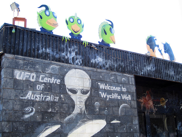
The only interesting stop on the way was at Wycliff Well for the UFO Centre of Australia.


Check-in/OK message from Steve and Jodie's SPOT Personal Tracker

Steve and Jodie's
Latitude:-20.56844
Longitude:134.26404
GPS location Date/Time:06/21/2012 15:39:59 EST

Message:We are ok and nothing to report. Check your e-mail to see us on the map.

Click the link below to see where I am located.
http://fms.ws/8Kb--/20.56844S/134.26404E

If the above link does not work, try this link:
http://maps.google.com/maps?f=q&hl=en&geocode=&q=-20.56844,134.26404&ll=-20.56844,134.26404&ie=UTF8&z=12&om=1

Steve and Jodie's

You have received this message because Steve and Jodie's has added you to their SPOT contact list.

Every day is an Adventure. Share Yours.
http://www.findmespot.com

Wednesday 20 June 2012

Oz Trip - Day 50

Day 50 – 20/6/2012 – N'Darla Gorge and Traphena Gorge Day Trip

We set off early so that we could fit both gorges into the one day. On the way to N'Darla gorge we stopped of at the Ross River Resort. Again the word Resort was being used rather loosely but the campground look really nice.

The trip into N'Darla gorge was a very scenic 4WD track. This time Jodie was driving. It was good experience for her as there were a number of small river crossings and a little bit of soft sand and rocks.

In the middle of one creek crossing


Tuesday 19 June 2012

Oz Trip - Day 49

Day 49 – 19/6/2012 – Diesel Heater Fixed!

And not a moment too soon! It was the coldest morning so far, -0.2 deg. Because the heater couldn't get fixed until 1:30pm we had to stay another night. We also decided that we would stay an additional night so that we could do a day trip the following day to the East MacDonnell Ranges.

Monday 18 June 2012

Oz Trip - Day 48


Day 48 – 18/6/2012 – Old Telegraph Station

Still no diesel heater parts so we occupied ourselves with a visit to the Old Telegraph Station. Since we didn't get to the Old Peake Telegraph Station on the Oodnadatta Track, this one would give us a bit of an idea of what it was like. All of the telegraph stations along the old telegraph line had pretty much the same layout.  Just that we couldn't camp amongst these ones.


Sunday 17 June 2012

Oz Trip - Day 47

Day 47 – 17/6/2012 – Return from Chambers Pillar

We were packed up and left at 10am to head back into Alice Springs.

Climbing the ridge from the other direction


Check-in/OK message from Steve and Jodie's SPOT Personal Tracker

Steve and Jodie's
Latitude:-23.73476
Longitude:133.87172
GPS location Date/Time:06/17/2012 15:59:35 EST

Message:We are ok and nothing to report. Check your e-mail to see us on the map.

Click the link below to see where I am located.
http://fms.ws/8HOS0/23.73476S/133.87172E

If the above link does not work, try this link:
http://maps.google.com/maps?f=q&hl=en&geocode=&q=-23.73476,133.87172&ll=-23.73476,133.87172&ie=UTF8&z=12&om=1

Steve and Jodie's

You have received this message because Steve and Jodie's has added you to their SPOT contact list.

Every day is an Adventure. Share Yours.
http://www.findmespot.com

Check-in/OK message from Steve and Jodie's SPOT Personal Tracker

Steve and Jodie's
Latitude:-24.86938
Longitude:133.82959
GPS location Date/Time:06/17/2012 10:34:16 EST

Message:We are ok and nothing to report. Check your e-mail to see us on the map.

Click the link below to see where I am located.
http://fms.ws/8HFDE/24.86938S/133.82959E

If the above link does not work, try this link:
http://maps.google.com/maps?f=q&hl=en&geocode=&q=-24.86938,133.82959&ll=-24.86938,133.82959&ie=UTF8&z=12&om=1

Steve and Jodie's

You have received this message because Steve and Jodie's has added you to their SPOT contact list.

Every day is an Adventure. Share Yours.
http://www.findmespot.com

Saturday 16 June 2012

Oz Trip - Day 46

Day 46 – 16/6/2012 – Chambers Pillar

Because the heater parts hadn't turned up by Friday and we were getting a bit bored sitting around camp, we decided to pack up and head out to Chambers Pillar for the night.

It took us about 3 ½ hours to do the 160 or so kilometres. The first part of the road to Chambers Pillar is alongside of the Old Ghan Railway and is the road that everyone used for camping along the rally track. After about 15,000 people had been along it in the last week or so, it was pretty rough.

On our way we also passed the same old guy on a push bike that we had passed on the Oodnadatta track! He was heading towards Alice Springs. Talk about doing it the tough way. I will take my air conditioned 4WD any day thanks!


Check-in/OK message from Steve and Jodie's SPOT Personal Tracker

Steve and Jodie's
Latitude:-24.87267
Longitude:133.82826
GPS location Date/Time:06/16/2012 14:01:09 EST

Message:We are ok and nothing to report. Check your e-mail to see us on the map.

Click the link below to see where I am located.
http://fms.ws/8GW2a/24.87267S/133.82826E

If the above link does not work, try this link:
http://maps.google.com/maps?f=q&hl=en&geocode=&q=-24.87267,133.82826&ll=-24.87267,133.82826&ie=UTF8&z=12&om=1

Steve and Jodie's

You have received this message because Steve and Jodie's has added you to their SPOT contact list.

Every day is an Adventure. Share Yours.
http://www.findmespot.com

Tuesday 12 June 2012

Oz Trip - Day 42 to Day 45

Day 42 to Day 45 – 12/6/2012 to 15/6/2012 - Alice Springs

Over the next couple of days we had a heap of jobs that needed doing along with having a few sleep ins due to the early starts to get to the rally.

We also had a guy coming to look at our diesel heater. I think because I didn't drain the diesel out of the tank over our summer months, there was a bit of green slime growing around the outlet in the tank and also in the inline filter. I think this then caused the heater to gum up and was blowing a lot of smoke and cutting in and out. The service technician also said that it needed a new glow plug and the gauss in the heater was blocked and he would have to order parts in. So it looked like we were going to be in Alice for a little while.

We had the annex walls up to help stop the cold wind

Monday 11 June 2012

Oz Trip - Day 41

Day 41 – 11/6/2012 – Rally end day

Because day two of the rally started at 7:30am at the Finke end of the track we didn't have to have as early a start as the previous days. The first of the buggies were due at the finish line at about 9:30am so we arrived at the track at about 8:30 so that we could get a good vantage point and early morning Gloria Jeans hot chocolates – a ritual for the last couple of mornings.
This is how we could tell the lead vehicle was getting close

Sunday 10 June 2012

Oz Trip - Day 40

Day 40 – 10/6/2012 – Rally start day

It was a very early start so that we could catch the first of the buggies off the start line at 7:30am!!! On top of that it was another 0deg morning. Stage 1 of the rally was 200 odd kilometres south along the Old Ghan Railway line to Finke.

What can I say, Jodie puts up with a lot from me. Dragging her out to the middle of nowhere in the middle of winter.


Saturday 9 June 2012

Oz Trip - Day 39

Day 39 – 9/6/2012 – Finke Prologue

It wasn't easy getting up early on a 0deg morning for a 9am start for the prologue. The prologue was the time trial that all vehicles did to determine the starting order for the following day. We missed the first few buggies due to the line up to get in the gate. However we still managed to see a few of the big monster trucks take off. They sounded awesome!
The line up along the Stuart Highway to get in

Friday 8 June 2012

Oz Trip - Day 38

Day 38 – 8/6/2012 – Alice Springs (Finke Desert Rally Scrutineering)

Unfortunately, we awoke to a beautiful morning. We wished we had this morning yesterday! As it so often happens, the day that you have to leave, is always the best.

We packed up camp and headed for Alice Springs. Our only real time line for the whole trip, (apart from having to go back to work :- ( ), was to make it to Alice Springs for the Finke Desert Rally. It is Australia's premier off-road rally, similar to the Dakar Rally but much shorter and smaller.
Heading to Alice Springs - MacDonnell Ranges in the distance

Check-in/OK message from Steve and Jodies SPOT SPOT Personal Tracker

Steve and Jodie's SPOT
Latitude:-23.73471
Longitude:133.87186
GPS location Date/Time:06/08/2012 13:27:28 EST

Message:We are ok and nothing to report. Check your e-mail to see us on the map.

Click the link below to see where I am located.
http://fms.ws/8A14D/23.73471S/133.87186E

If the above link does not work, try this link:
http://maps.google.com/maps?f=q&hl=en&geocode=&q=-23.73471,133.87186&ll=-23.73471,133.87186&ie=UTF8&z=12&om=1

Steve and Jodie's SPOT

You have received this message because Steve and Jodie's SPOT has added you to their SPOT contact list.

Every day is an Adventure. Share Yours.
http://www.findmespot.com

Thursday 7 June 2012

Oz Trip - Day 37

Day 37 – 7/6/2012 – Still at Palm Valley

Because it was such a nice camp ground we decided to stay an extra day. Unfortunately the weather wasn't as nice today as the day before. It clouded over, was cold and there was a wind blowing. I had to get the second set of solar panels out to try and catch as many rays as possible for power.

The rest day also gave me a chance to catch up on writing some more of the blog posts so that when I had internet coverage that it would be quicker to publish them.

The camp ground pretty much cleared out and was back to 4 groups, but by the afternoon every site was occupied again.  Later that afternoon the family that we met at Gosse Bluff pulled in and setup camp only a couple of sites away.

That night we went to the Ranger talk around the camp fire. It seems that in most of the popular NT National Parks, a Ranger from that park will come out one night a week and answer questions around the camp fire. It was very interesting. There are only 3 permanent rangers that look after the Finke National Park, (Palm Valley and Boggy Hole).  They actually live at Palm Valley in the rangers quarters.  She said that they sometimes get cut off in the wet season when the river floods.  After seeing the track in it is pretty easy to see why.

Wednesday 6 June 2012

Oz Trip - Day 36

Day 36 – 6/6/2012 – Palm Valley

We packed up and left Glen Helen. We had to do a bit of back tracking to Hermannsburg to access the Palm Valley camp ground in the Finke Gorge National Park. It was a 4WD only camp ground. We ended up choosing Palm Valley because it sounded a lot easier to get into then the Boggy Hole section of the Finke National Park.

Good thing we are making an early start!

Check-in/OK message from Steve and Jodie's SPOT SPOT Personal Tracker

Steve and Jodie's SPOT
Latitude:-24.05733
Longitude:132.74597
GPS location Date/Time:06/06/2012 13:01:45 EST

Message:We are ok and nothing to report. Check your e-mail to see us on the map.

Click the link below to see where I am located.
http://fms.ws/88VZY/24.05733S/132.74597E

If the above link does not work, try this link:
http://maps.google.com/maps?f=q&hl=en&geocode=&q=-24.05733,132.74597&ll=-24.05733,132.74597&ie=UTF8&z=12&om=1

Steve and Jodie's SPOT

You have received this message because Steve and Jodie's SPOT has added you to their SPOT contact list.

Every day is an Adventure. Share Yours.
http://www.findmespot.com

Tuesday 5 June 2012

Oz Trip - Day 35

Day 35 – 5/6/2012 – West MacDonnell Gorges Day 2

The mornings are starting to get chiller. This morning it was a whole 0.2 deg cooler than the day before getting down to 0.3 deg.

The first gorge we visited was Ormiston gorge. There was a loop walk that took you along the ridge and then down into the gorge and back via the river bed. We didn't do the full loop as there was a bit of water that you needed to cross. We went up to the look out and then back up the gorge as far as we could.

Looking up Ormiston Gorge

Monday 4 June 2012

Check-in/OK message from Steve and Jodie's SPOT SPOT Personal Tracker

Steve and Jodie's SPOT
Latitude:-23.68567
Longitude:132.6745
GPS location Date/Time:06/04/2012 17:46:35 EST

Message:We are ok and nothing to report. Check your e-mail to see us on the map.

Click the link below to see where I am located.
http://fms.ws/8791V/23.68567S/132.6745E

If the above link does not work, try this link:
http://maps.google.com/maps?f=q&hl=en&geocode=&q=-23.68567,132.6745&ll=-23.68567,132.6745&ie=UTF8&z=12&om=1

Steve and Jodie's SPOT

You have received this message because Steve and Jodie's SPOT has added you to their SPOT contact list.

Every day is an Adventure. Share Yours.
http://www.findmespot.com

Oz Trip - Day 34

Day 34 – 4/6/2012 – West MacDonnell Gorges Day 1

We were basing ourselves at Glen Helen so that we could visit most of the Gorges in the West MacDonnell Ranges. The West MacDonnell Ranges were a pretty impressive geological formation.

West MacDonnall Ranges

Sunday 3 June 2012

Check-in/OK message from Steve and Jodie's SPOT SPOT Personal Tracker

Steve and Jodie's SPOT
Latitude:-23.68568
Longitude:132.6745
GPS location Date/Time:06/03/2012 17:07:45 EST

Message:We are ok and nothing to report. Check your e-mail to see us on the map.

Click the link below to see where I am located.
http://fms.ws/86Slm/23.68568S/132.6745E

If the above link does not work, try this link:
http://maps.google.com/maps?f=q&hl=en&geocode=&q=-23.68568,132.6745&ll=-23.68568,132.6745&ie=UTF8&z=12&om=1

Steve and Jodie's SPOT

You have received this message because Steve and Jodie's SPOT has added you to their SPOT contact list.

Every day is an Adventure. Share Yours.
http://www.findmespot.com

Oz Trip - Day 33

Day 33 – 3/6/2012 – Kings canyon to Glen Helen “Resort”

We packed up camp early and left for Glen Helen via the Mereenie Loop Road. To travel this road you required a permit which only cost $5.50. More dirt and corrugations. Smoko stop was at a lookout that looked back onto Kings Canyon.

Looking back onto Kings Canyon

Saturday 2 June 2012

Oz Trip - Day 32

Day 32 – 2/6/2012 – Kings Canyon Rim walk

We set off reasonably early to do the Kings Canyon Rim walk. There was a steep climb at the start of the walk but it had steps so it wasn't too bad. It was a good cardio workout.

The start of the walk

Friday 1 June 2012

Check-in/OK message from Steve and Jodie's SPOT SPOT Personal Tracker

Steve and Jodie's SPOT
Latitude:-24.24979
Longitude:131.51315
GPS location Date/Time:06/01/2012 14:32:16 EST

Message:We are ok and nothing to report. Check your e-mail to see us on the map.

Click the link below to see where I am located.
http://fms.ws/84xum/24.24979S/131.51315E

If the above link does not work, try this link:
http://maps.google.com/maps?f=q&hl=en&geocode=&q=-24.24979,131.51315&ll=-24.24979,131.51315&ie=UTF8&z=12&om=1

Steve and Jodie's SPOT

You have received this message because Steve and Jodie's SPOT has added you to their SPOT contact list.

Every day is an Adventure. Share Yours.
http://www.findmespot.com

Oz Trip - Day 31

Day 31 – 1/6/2012 – Yalara to Kings Canyon

Finally on the road again. We left Yalara and headed for Kings Canyon. We setup camp in the unpowered section of the “Resort”. It was good to have a bit of space around us again. We thought the definition of “Resort” was being stretched a bit. It wasn't a bad van park but “Resort” was stretching it a bit.

Campsite in Kings Canyon Resort